Ascension Island
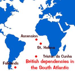
Ascension
Island is an island in
the South Atlantic Ocean, around 1,600 km from the coast of Africa. It is a dependency of the British overseas territory of Saint Helena, which is 1,287 km to
the south east. The Island is named after the
day of its recorded discovery, Ascension Day.
Ascension
Island became inhabited in 1815, when the British garrisoned it as a precaution
after imprisoning Napoleon I on St Helena to
the southeast. The location of the island made it a useful stopping point for
ships and communications. The Royal Navy used the island as a victualling station for ships. In 1922, Letters Patent made
Ascension a dependency of Saint Helena.
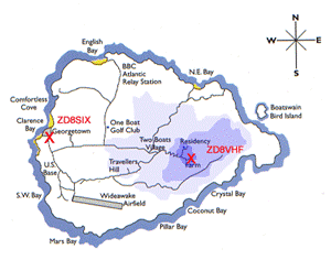
The
island is the location of Wideawake Airfield, which
was built by US during WWII and is a joint facility of the Royal Air Force and
the United States Air Force. The Island was
used extensively by the British military during the Falklands War. Ascension
Island hosts one of three ground antennas (others are on Kwajalein and Diego Garcia) that assist in the
operation of the Global Positioning System (GPS) navigational system.