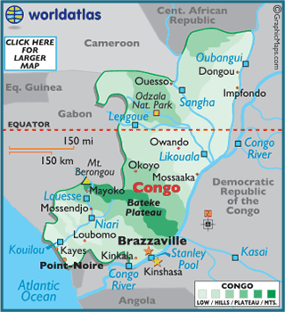
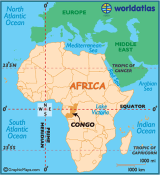
Republic of Congo
The Republic of the Congo,
also referred to as Congo-Brazzaville,
is a country located in Central Africa. It is
bordered by Gabon, Cameroon, the Central
African Republic, the Democratic
Republic of the Congo and the Angolan exclave of Cabinda.
The area north of the Congo River came under French sovereignty in 1880. This
Congo Colony became known first as French Congo, then as Middle Congo in 1903. In 1908, France
organized French Equatorial Africa (AEF), comprising Middle Congo, Gabon, Chad,
and Oubangui-Chari (the modern Central
African Republic). Brazzaville was selected as the federal
capital.
During the Nazi occupation of France during World War II, Brazzaville functioned as the symbolic
capital of Free France between 1940 and 1943. Middle Congo
became known as the Republic of the Congo in 1958 and published its
first constitution in 1959. The Republic of the Congo
was granted full independence from France on August 15, 1960. The People's Republic of the Congo
was a Marxist-Leninist single-party state from 1970 to 1991. Multiparty
elections have been held since 1992, although a democratically elected
government was ousted in the 1997 Republic of the Congo Civil War.