Cuba
The Republic of Cuba
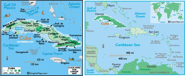
is an island country in the Caribbean. It
consists of the island
of Cuba, the Isla de la
Juventud, and several archipelagos. Cuba is an archipelago of
islands located in the northern Caribbean Sea at the confluence with the Gulf
of Mexico and the Atlantic Ocean. The United States lies to the north-west, the Bahamas to the north, Haiti
to the east, Jamaica and the
Cayman Islands to the south, and Mexico to the west.
Prior to the arrival of
the Spanish, the island was inhabited by Native American peoples. After Christopher
Columbus landed near what is now Baracoa in 1492,
Cuba remained a Spanish
possession for almost 400 years (1511–1898). After the Spanish-American War, Spain ceded Cuba
to the U.S..
Cuba gained formal
independence from the United States
on May 20, 1902 as the Republic
of Cuba. Under the new
constitution, however, the U.S.
retained the right to intervene in Cuban affairs and to supervise its finances
and foreign relations. Under the Platt Amendment, the U.S. leased the Guantánamo
Bay naval base from Cuba.
In 1959, the 26th of July
Movement led by Fidel Castro and Che Guevara overthrew Batista, a dictator, government,
established a new revolutionary government. The 1961 Bay of Pigs Invasion was
an unsuccessful attempt to overthrow the Cuban government by a U.S.-trained
force of Cuban exiles with U.S.
military support. In 1960, Fidel Castro's government nationalized private
property totaling about $25 billion US dollars. By 1963, Cuba was moving towards a full-fledged Communist
system modeled on the USSR.
The U.S. imposed a complete
diplomatic and commercial embargo on Cuba. Castro's rule was severely
tested in the aftermath of the Soviet collapse. The food shortages were similar
to North Korea.