Eritrea
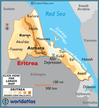
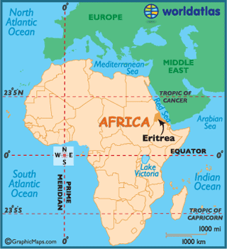
Eritrea, officially the State
of Eritrea, is a country in the Horn of Africa. Eritrea is the Italian form
of the Greek name Ἐρυθραία (Erythraía ), meaning
"red [land]". It is bordered by Sudan,
Ethiopia and Djibouti. The
northeastern and eastern parts of Eritrea
have an extensive coastline along the Red Sea, across from Saudi Arabia and Yemen. The nation has a total area
of approximately 117,600 km2, and includes the Dahlak
Archipelago and several of the Hanish
Islands. Most people in
the territory adhere to Christianity or Islam.
The Kingdom of Aksum, covering much of modern-day Eritrea and northern Ethiopia, rose somewhere around the
first or second centuries and adopted Christianity shortly after its formation.
In medieval times much of Eritrea
fell under the Medri Bahri Kingdom,
with a smaller region being part of the Hamasien Republic.
The creation of modern day Eritrea
is a result of the incorporation of independent Kingdoms and various vassal
states of the Ethiopian empire and the Ottoman Empire,
eventually resulting in the formation of Italian Eritrea. In 1947 Eritrea became part of a federation with Ethiopia, the Federation of Ethiopia and Eritrea.
Subsequent annexation by Ethiopia
led to the Eritrean War of Independence, ending with Eritrean independence in
1991.