Guinea
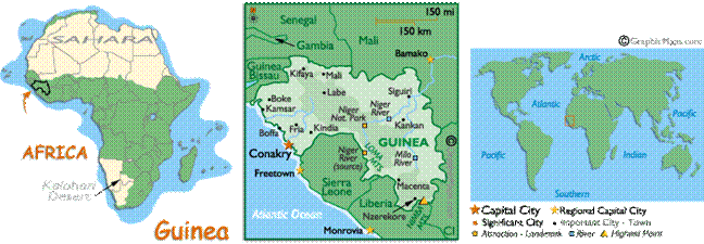
Guinea, officially Republic of Guinea,
is a country in West Africa formerly known as French
Guinea. Its territory has a crescent shape, with its western border on the Atlantic Ocean, curving inland to the east and south. Guinea borders Guinea-Bissau,
Senegal, Mali, Côte
d'Ivoire, Liberia
and Sierra Leone.
The Niger River runs through the nation,
providing both water and irregular transportation.
The land composing present-day Guinea was part
of a series of empires, beginning with the Ghana Empire which came into being
around 900 AD. This was followed by the Sosso kingdom
in the twelfth and thirteenth centuries. The Mali Empire took control of the
region after the Battle of Kirina in 1235, but grew
weaker over time from internal conflicts, which eventually led to its
dissolution. An Islamic state was founded in the eighteenth century which
brought stability to the region.
France colonized Guinea in 1890. In 1895 the country
was incorporated into French West Africa. Guinea became
the first French African colony to gain independence, on 2 October 1958, at the
cost of the immediate cessation of all French assistance.
In 50 years after independence, Guinea was governed by two dictators, each of
whom had controlled Guinea
for about 25 years.