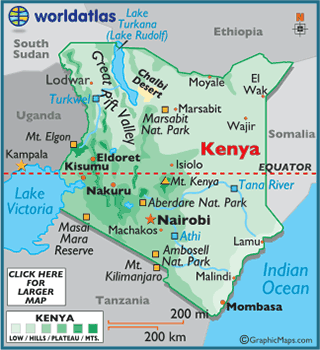
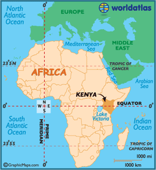
Kenya
Kenya,
officially the Republic of Kenya,
is a sovereign state in the African Great Lakes region of East
Africa. Kenya
lies on the equator with the Indian Ocean to the south-east, it shares border
with Tanzania, Uganda, South Sudan, Ethiopia
and Somalia.
The country is named after Mount Kenya, the second highest mountain in Africa.
The
earliest inhabitants of Kenya
were hunter-gatherers but from about 2,000 BC herders came to the region. Then
from about 800 AD Arabs sailed to Kenya. Some settled and
intermarried and they created the Swahili culture along the coast.
The
first European to reach Kenya
was in 1498. Subsequently the Portuguese dominated the coast of Kenya for 2
centuries. However they did not penetrate inland. Still the Portuguese brought
new crops to Kenya,
maize and cassava.
Then in
the late 19th century Kenya
came under British control. At first Kenya was administered by the
Imperial British East Africa Company, which was formed in 1887. However in 1895
the British government took responsibility for Kenya. In the early 20th century
while settlers flocked into Kenya
taking the best land and the natives were forced onto reservations. Indians
also came to Kenya
and formed a middle class or traders.
In 1961
an African political party Kenya African National Union was formed and in May
1963 KANU won a majority of seats in the Kenyan assembly. Kenya became
independent on 12 December 1963.