Malawi
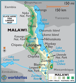
Malawi, officially the Republic of Malawi,
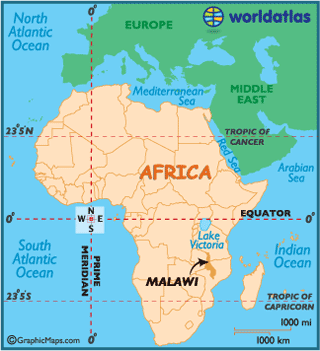
is a landlocked country in southeast Africa that was formerly known as Nyasaland. It is bordered by Zambia,
Tanzania and Mozambique. The
country is separated from Tanzania
and Mozambique by Lake Malawi.
The area of Africa now known as Malawi was
settled by migrating Bantu groups around the 10th century. Centuries later in
1891 the area was colonized by the British. In 1953 Malawi,
then known as Nyasaland, became part of the
semi-independent central African Federation (CAF). The Federation was dissolved
in 1963 and in 1964, Nyasaland gained full independence and was renamed Malawi.
Malawi is among the world's least-developed
countries. The economy is heavily based in agriculture, with a largely rural
population. The Malawian government depends heavily on outside aid to meet development
needs.