Martinique
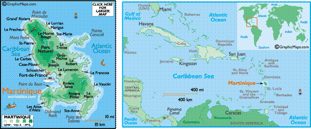
Martinique is an island in the eastern Caribbean Sea, with a land area of 1,128 km2.
It is an overseas department of France.
To the northwest lies Dominica,
to the south St
Lucia, and to the southeast Barbados.
As with the other overseas departments, Martinique is one of the twenty-six regions
of France
(being an overseas region) and an integral part of the Republic.
As part of France, Martinique
is part of the European Union, and its currency is the euro. Its official
language is French, although many of its inhabitants also speak Antillean
Creole.
Prior to the discovery of Martinique by Columbus in 1493, the
area was inhabited by Arawak and Carib Indians. There was no real European
interest in the island until French colonies were established in 1635. Though
the British made brief attempts to occupy the island during the 18th and 19th
centuries, it has remained under French control ever since (along with Guadeloupe). Slavery was abolished in 1848 and, in the
late 19th century, tens of thousands of immigrant workers arrived from India to
replace the slave workforce on the plantations. Both Martinique and Guadeloupe were administered as parts of French Antilles.
In 1946, rather than following a path to independence, the two islands were
incorporated into the French nation with the status of Overseas Departments.