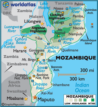
Mozambique
Mozambique, officially the Republic of Mozambique,
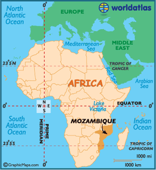
is a country in southeastern Africa bordered by the Indian Ocean to the east, Tanzania to the north, Malawi and Zambia
to the northwest, Zimbabwe
to the west and Swaziland
and South Africa
to the southwest. The capital city is Maputo,
formerly known as Lourenço Marques. Mozambique’s official language is
Portuguese. It is a member of the Commonwealth and is one of the two members
which is not former part of the British Empire.
Between the 1st and 5th centuries
AD, Bantu-speaking peoples migrated from farther north and west. Swahili, and
later also Arab, commercial ports existed along the coasts until the arrival of
Europeans. The area was colonized by Portugal in 1505. In the early 20th
century the Portuguese shifted the administration of much of Mozambique to
large private companies, like the Mozambique Company, the Zambezia Company and
the Nyassa Company, controlled and financed mostly by the British, which established
railroad lines to neighboring countries. Due to their unsatisfactory
performance and the shift towards a stronger Portuguese control of Portuguese
empire's economy, the companies' concessions were not renewed when they ran
out. This was what happened in 1929 with the Nyassa Company and in 1942 with
the Mozambique Company. In 1951, the Portuguese overseas colonies in Africa
were rebranded as Overseas Provinces of Portugal.
Mozambique
became independent in 1975, and became the People's Republic of Mozambique
shortly after. It was the scene of an intense civil war lasting from 1977 to
1992.