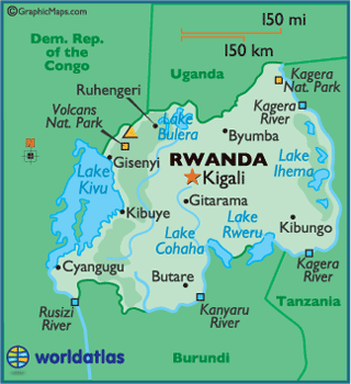
Rwanda
Rwanda, officially the Republic of Rwanda,
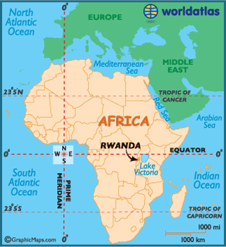
is a sovereign state in central and east Africa.
Located a few degrees south of the Equator, Rwanda
is bordered by Uganda, Tanzania, Burundi,
and the Democratic Republic
of the Congo. Christianity is the largest
religion in the country, and the principal language is Kinyarwanda, which is
spoken by most Rwandans.
Rwandans form three groups: the Hutu, Tutsi, and Twa. The
Kingdom of Rwanda dominated from the mid-eighteenth
century, with the Tutsi kings conquering others militarily, centralizing power,
and later enacting anti-Hutu policies. Germany
colonized Rwanda in 1884,
followed by Belgium,
which invaded in 1916 during World War I. Both European nations ruled through
the Kings and perpetuated pro-Tutsi policy. The Hutu population revolted in
1959, massacring a large number of Tutsi and ultimately establishing an
independent Hutu-dominated state in 1962. The Tutsi-led Rwandan Patriotic Front
launched a civil war in 1990, which was followed by the 1994 genocide, in which
Hutu extremists killed an estimated 500,000 to 1 million Tutsi and moderate
Hutu. The RPF ended the genocide with a military victory.
Rwanda's economy suffered heavily during the 1994 Rwandan
Genocide, but has since strengthened. The economy is based mostly on subsistence
agriculture. Coffee and tea are the major cash crops for export. Tourism is a
fast-growing sector and is now the country's leading foreign exchange earner.