Spain
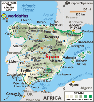
Spain, officially
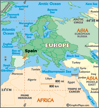
the Kingdom of Spain locates on the Iberian Peninsula in southwestern
Europe. Its mainland is bordered to France, Andorra, Portugal, the Atlantic
Ocean and the Mediterranean Sea except for a small land boundary with Gibraltar;
Spanish territory also includes
two archipelagos; the Balearic Islands, in the Mediterranean Sea, and the Canary
Islands, in the Atlantic Ocean off the African coast; two major exclaves, Ceuta
and Melilla, in continental North Africa. Spain is the second largest country in
Western Europe and the European Union, and the fourth largest country in Europe.
Modern humans first arrived in
the Iberian Peninsula around 35,000 years ago. Iberian cultures along with
ancient Phoenician, Greek and Carthaginian settlements developed on the
peninsula until it came under Roman rule around 200 BCE, after which the region
was named Hispania. In the Middle Ages, the
area was conquered by Germanic tribes and later by the Moors. Spain emerged as
a unified country in the 15th century, following the marriage of the Catholic
Monarchs and the completion of the centuries-long reconquest of the
peninsula from the Moors in 1492. In the early modern period, Spain became one
of history's first global colonial empires, leaving a vast cultural and
linguistic legacy that includes over 500 million Spanish speakers, making
Spanish the world's second most spoken first language.
Spain remained neutral in World War I and
II but suffered through a devastating civil war (1936-39). A peaceful
transition to democracy following the death of dictator
Francisco FRANCO in 1975, and rapid economic modernization (Spain joined the EU
in 1986) gave Spain a dynamic and rapidly growing.